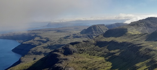
Pre-meeting excursion to the Sornfelli summit, - a potential climate monitoring site
Excursion to this unique facility to study various meteorological aspects in low arctic climate at 740 meter above sea level only less than 30 minutes drive, or one hour hike, from cool temperate/subarctic climate near sea level.

On Tuesday, the day before the meeting, we would like very much to invite you to visit this unique facility to study and monitor the mountain meteorology and climate in the North Atlantic. We will drive on paved roads up to about 680m elevation, and then we will have a guided tour trough tunnels and up a staircase of about 220 steps inside the mountain to the top about 746 m above sea level. In clear weather most of the island group can be seen from here.
Sornfelli's extreme environment and strategic North Atlantic position make it a valuable location for understanding both local mountain climate dynamics and broader regional and global climate change influences. Its strategic location is seen as a unique opportunity to study key atmospheric components like sea spray aerosols, long-range pollution, and climate gases, particularly as a gateway to the Arctic.
Performing meteorological observations at this site has shown to be a challenge, and thus a unique easy accessible site to test out equipment for extreme environment. In 1999 - 2000 an attempt was made by Jarðfeingi (Faroese Geological Survey) and its partners to establish a meteorological station on this summit using a new technology where instruments were only periodically exposed from a heated cylinder, protecting them from the extreme conditions of strong winds, icing and lightening. Later instrumentation on a special designed mast was tested. Further operation of this station ceased due to lack of resources. These efforts however demonstrated that this location offers a unique setting for monitoring meteorological conditions in the southernmost part of the northern hemisphere low arctic zone.
The installation on and in the Sornfelli was established in the early 1960’ies as a NATO Early Warning station as a result of the political tension during the Cold War period. Following the end of the Cold War and change in strategic priorities the main military installation was closed in 2002 and the surveillance radar stopped operating completely in 2007, when it become part of the Faroese Government property portfolio. Recently a political agreement was made between the Faroese and Danish governments to establish a new air surveillance radar into these facilities.
Today these facilities hosts the local weather radar own by the local airline and helicopter company Atlantic Airways, which makes these observations publicly available among other medias also on the FMO homepage (www.vedur.fo). In addition the facility provides opportunities and space for some few research experiments. We at FMO would like very much to introduce to you these unique and easy accessible facility for meteorological and climate research, and to discus future collaborative research and monitoring projects.
Practical Information
Please note that registration is required for this excursion. This excursion will start from the FMO facility in Torshavn, last about 3 hours and ends at the venue of the icebreaker.
Reservations are made for possible changes.
Further reading
Christiansen, H. H., and L. Mortensen, 2002. Arctic Mountain Meteorology at the Sornfelli Mountain in Year 2000 in the Faroe Islands. Fróðskaparrit- Faroese Scientific Journal, 2002. (pdf)
Christiansen, S. et al, Workshop organized by the University of the Faroe Islands to establish and integrated marine and atmospheric monitoring station (Link)
Observations at Sornfelli in the FINI-project (Link)
Recent political agreement to establish air surveillance radar (Link)


 og vel